 SUMMARY
Hurricane Iniki was
the third most damaging hurricane in U.S. history, and the most
destructive to hit the Hawaiian Islands in this century. It was
a small but intense hurricane which was classified as a minimal
category Four on the Saffir-Simpson scale.
Hurricane Iniki, just south of Kauai, developed winds estimated
at 145 mph and gusts up to 175 mph. When Iniki moved over Kauai
in the afternoon of September 11, 1992, wind speeds were estimated
at 130 mph with gusts to 160 mph, and its central pressure was
approximately 945 millibars. Iniki was accompanied by storm tides
ranging from 4.5 to 6.3 feet above normal, with 20 to 35 foot
storm waves. Heavy waves battered coastal areas of southern Kauai
.The highest water levels and inundation of up to 22 feet above
mean lower low water (MLLW) were reported by the Army Corps of
Engineers near the Poipu area, just to the west of the Lawai
Beach Resort. However, flooding of up to 27 feet above MLLW was
reported by the Civil Defense, and University of Hawaii survey
claims maximum inundation of 29 feet above MLLW. These values
remain to be confirmed by more accurate surveys.
The eye of the Iniki crossed the Kauai Coast just west of Port
Allen near Kaumakani just before 4 PM Hawaiian Standard Time
(HST). The most severe damage in Kauai occurred on the south,
east and north of the island. At the Lawaii Beach Resort extensive
wind damage begun as early as 1:15 to 1:30 in the early afternoon
of September 11. It was around this time that extensive damage
to the Beach house Restaurant occurred and part of its roof blew
off.
Maximum flooding begun around 3:30, as indicated by the Port
Allen tide gauge, prior to the passage of the eye in the vicinity
of the Port Allen area. At that time the astronomical tide was
the highest and it was augmented by the reduction of the barometric
pressure as the hurricane moved over the island. Superimposed
on the higher elevation of the hurricane surge were the storm
waves which intensified around that time as the winds were maximum
and the landward component of wind friction reached its maximum
value at the Lawaii Beach Resort around that time.

INTRODUCTION
Hurricane Track
Iniki was well tracked
and average wind velocities and maximum winds were fairly well
estimated during its development, or measured by aerial reconnaissance
dropsondes during its fully developed phase on the 10th and 11th
September 1992 (See the tracks, positions, and satellite thermal
data in this report). Had this hurricane hit the island of Oahu,
damage would have been much greater, and hundreds of deaths would
have occurred.
Translational Speed
As the hurricane approached
Kauai, its translational speed increased considerably to 30 mph
making its passing quick but devastating. Had the translational
speed been slower, the damage on Kauai would have been much worse.
Iniki's path over Kauai is shown. Maximum winds were experienced
near Poipu.
Water Level Measuring
Stations
On Kauai, the NOS
tide station at Port Allen was the only continuous recording
of water level as affected by hurricane Iniki. On Oahu a continuous
recording of water level was made by the NOS tide station at
the Coast Guard pier in Honolulu Harbor. These stations also
recorded the barometric pressure fluctuations. (See the hydrographs
for Port Allen and Honolulu in the data section of this report.)
Wind Reporting Stations
There is a great
deal of wind data that has been collected for historical hurricanes
occurring in the Gulf and Florida Coasts. However not much wind
data has been collected for hurricanes occurring in the vicinity
of the Hawaiian Islands because there can only be a few recording
stations on land. There are ocean buoys that can provide both
wind and wave data, but only deep water buoy 51002, anchored
some 280 miles south southeast of Honolulu, was close enough
to record any data. Only wave data was collected by this buoy.
On the island of Kauai, only WSO Lihue, the Navy station at Barking
Sands, and stations at Makahuena, Princeville, Makaha Ridge,
and Port Allen provided some wind data some of the time. There
is not a great deal of wind data for the southern part of the
island of Kauai. The only stations that reported briefly wind
data were Port Allen and Makahuena (until it lost power). All
available wind data is given in the data section of this report.
THE
WIND AND WATER EFFECTS AT
POIPU (LAWAI BEACH RESORT), ISLAND OF KAUAI, HAWAIIAN ISLANDS
Reported or Reconstructed
Wind Chronology and Wind Directions of Iniki on September 11,
1992, at the Lawai Beach Resort, at Poipu Beach.
 All
available wind data was collected for the islands of Kauai and
Oahu (see tables). Data from Port Allen, Makahuena, and Lihue,
were used in the assessment of wind speed and direction sequence
at Lawai Beach Resort. A maximum of 227 MPH was reported from
the Navy radar site at Makaha Ridge. This has been depicted as
an anomaly due to improper instrument calibration; therefore
unrealistic. I do not entirely agree with that. It may be possible
to achieve such wind speeds from funneling (venturi) effects.
The research by Dr. Fujita indicates that anomalous winds such
as severe short lived downdrafts occur with some frequency. However,
this may be an anomaly localized in a few areas.
All
available wind data was collected for the islands of Kauai and
Oahu (see tables). Data from Port Allen, Makahuena, and Lihue,
were used in the assessment of wind speed and direction sequence
at Lawai Beach Resort. A maximum of 227 MPH was reported from
the Navy radar site at Makaha Ridge. This has been depicted as
an anomaly due to improper instrument calibration; therefore
unrealistic. I do not entirely agree with that. It may be possible
to achieve such wind speeds from funneling (venturi) effects.
The research by Dr. Fujita indicates that anomalous winds such
as severe short lived downdrafts occur with some frequency. However,
this may be an anomaly localized in a few areas.
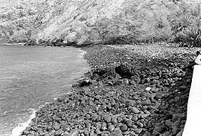
Before and after Iniki
photos of beach in Kauai.
 No other such anomaly was reported
elsewhere, and it certainly would not require winds of such strength
to do the damage. Winds of much lower speed were responsible
for most of the damage. Based on the scant data that was available
and from other data of better documented historical hurricanes,
a brief qualitative chronological sequence of winds at the Lawai
Beach Resort can be reasonably deduced. A more quantitative determination
of wind velocities and directions can be calculated using numerical
modelling techniques ( see Appendix, which is a partial report
entitled " Verification Study of a Bathystrophic Storm Model"
by George Pararas-Carayannis). This report explains the technique
for developing the wind field for historical and design hurricanes
and for calculating the extent of hurricane flooding. Such numerical
modelling can be used to develop a complete wind field for any
location based on a few measurements of actual wind speeds and
atmospheric pressure distributions. This was not done for the
present study as it is very time consuming. However, the available
wind information on hurricane Iniki from Lihue, Makahuena, and
elsewhere, was extrapolated to the Lawai Beach Resort. Patterns
of historical hurricanes were examined and available satellite
photos were analyzed, the time history of wind velocities and
directions for only one point (Beach House Restaurant) were determined
using the technique outlined in the Appendix (pages 70, 71, 72).
Using such data and methods the chronology of wind speeds and
directions which affected the Beach House Restaurant on September
11, 1992, was deduced (See diagram showing the Lawaii Beach Resort
restaurant, and wind speeds and directions). Note that the destructive
winds that caused most of the damage at the restaurant , and
other buildings occurred between 1:00 PM and 2:00 PM and were
primarily from an eastern direction.
No other such anomaly was reported
elsewhere, and it certainly would not require winds of such strength
to do the damage. Winds of much lower speed were responsible
for most of the damage. Based on the scant data that was available
and from other data of better documented historical hurricanes,
a brief qualitative chronological sequence of winds at the Lawai
Beach Resort can be reasonably deduced. A more quantitative determination
of wind velocities and directions can be calculated using numerical
modelling techniques ( see Appendix, which is a partial report
entitled " Verification Study of a Bathystrophic Storm Model"
by George Pararas-Carayannis). This report explains the technique
for developing the wind field for historical and design hurricanes
and for calculating the extent of hurricane flooding. Such numerical
modelling can be used to develop a complete wind field for any
location based on a few measurements of actual wind speeds and
atmospheric pressure distributions. This was not done for the
present study as it is very time consuming. However, the available
wind information on hurricane Iniki from Lihue, Makahuena, and
elsewhere, was extrapolated to the Lawai Beach Resort. Patterns
of historical hurricanes were examined and available satellite
photos were analyzed, the time history of wind velocities and
directions for only one point (Beach House Restaurant) were determined
using the technique outlined in the Appendix (pages 70, 71, 72).
Using such data and methods the chronology of wind speeds and
directions which affected the Beach House Restaurant on September
11, 1992, was deduced (See diagram showing the Lawaii Beach Resort
restaurant, and wind speeds and directions). Note that the destructive
winds that caused most of the damage at the restaurant , and
other buildings occurred between 1:00 PM and 2:00 PM and were
primarily from an eastern direction.
Estimated
Wind Sequence and Chronology of Events at Poipu Beach
The Wind sequence
and chronology at Poipu Beach were estimated by the author based
on application of a mathematical model ("Verification Study
of a Bathystrophic Strom Surge Model" by George Pararas-Carayannis,
Technical Memorandum No. 50, U.S. Army, Corps of Emgineers, Coastal
Engineering Research Center, May 1975, a study supported by the
U.S. Atomic Energy Commission (AEC)(now, U.S. Nuclear Regulatory
Commission).
1. 8 AM, HST: The storm center was about 180 miles south of Kauai.
The intensity of the winds had reached a peak of 145 mph with
gusts as high as 175 mph. Winds at the Lawaii Beach Resort were
somewhat strong but not unusual. Perhaps gusts of up to 35-40
mph were experienced.
2. 11 AM, HST: The center of Iniki was near 20 N and 160 W, about
130 miles south southwest of Lihue, moving northward at 17 mph.
Maximum winds remained at 145 mph with gusts to 175 mph. Gusts
at the Lawaii Beach Resort were gusting up to 55 mph.
3. 12 Noon: Winds at Makahuena were from the east -northeast
(appr. 060) with sustained speeds of 55 mph with gusts of 62
mph. The Lawaii Beach Resort area was getting hit with similar
winds from the same direction. Some wind damage had begun already
in the area. Roofs of well constructed buildings were still intact.
4. 1 PM, HST: The center of Iniki was at 21.1 N and approximately
160 W, with winds remaining in the maimum range of 145 mph with
gusts to 175 mph. The hurricane translational speed was averaging
27 mph. At the Lawai Beach Resort winds were averaging 65 miles
per hour with gusts reaching 90 miles per hour. At this time
the roof of the Beach House restaurant began to lift and vibrate.
Evidence of gradual directional uplift can be seen in the photographs.
5. Sometime between 1 PM and 2 PM, and most probably around 1:15
to 1:30, wind strength at the Lawai Beach Resort ecxeeded the
wind design threshold of 80 to 100 mph of most buildings constructed
in the area. The following is the most probable sequence of events:
The winds were blowing from an eastern direction which accounts
also for the damage to that section of the Beach House restaurant
roof. Destruction begun gradually. First, one or two of the glass
windows(doors) in the eastern part of the restaurant blew in.
Subsequently glass walls and sliding glass doors on the makai
side of the restaurant blew out (Evidence of this was found on
the beach in front of the restuarant. Large pieces of glass and
of the window frame were collected there). Wind funneled through
the restaurant causing extensive damage. The roof at the eastern
part of the restaurant begun to vibrate and lift. The lifting
intensified until finally the roof acted as a sail catching the
wind, and blew off. The roof failure begun near the Kitchen area
(see photographs). The wind was forced in the attic space between
the roof and the plasterboard ceiling. The high pressure caused
by the wind, found a point of least resistance at the northwest
side of the building and blew the plasterboard ceiling downward.
Most of the roofs of the Alii Building were also blown off around
that time.
Evidence of this sequence of events was discovered. A detailled
inspection was made on the roof of the Beach House Restaurant.
A large section of the wind- removed roof still lies undisturbed
on the flat section of the roof above the kitchen where it was
deposited by the winds on September 11th. The location of this
piece of roof proves unquestionably that the winds that resulted
in the failure were from an eastern direction and were funnelled
between the two buildings to the east of the restaurant which
may have amplified the effects.The time of such wind occurrence
was between 1:00 and 2:00 P.M. and most likely around 1:30 P.M.
6. 2:30 PM, HST: , as Iniki approached closer, winds at Makahuena
were from the east (090) with average speeds of 80.6 mph and
gusts ranging from 115.5 mph to 143 mph. Winds at the Lawai Beach
Resort were similar in direction and speed. Destruction from
the wind was already complete at the Beach House Restaurant.
The roof of the Beach House Restaurant had already been blown
off. All lighter furnishings had blown away.
7. 3 PM, HST: The center of Iniki was very near the southern
coast of Kauai at 21.6 N and 159.7 W, about 37 miles soutwest
of Lihue. Forward translational speed had accelerated to 30 mph.
As a rule, winds are strongest when the flow is downslope. Therefore,
the strongest winds to hit the southern coast of the island occured
before the passage of the hurricane eye sometime between 3:15
and 3:30 PM.It is estimated that the winds by 3:00 p.m. had shifted
and were coming from a souteast direction at speeds averaging
100 miles per hour with gusts up to 130 mph. It is believed that
Poipu and the Lawai Beach Resort were some of the hardest hit
areas by wind around that time. Maximum winds hit the Beach House
Restaurant around that time, but destruction was already complete.
Winds of lesser strength had already blown the roof of the restaurant.
8. Between 3:30 and 4:00 PM, HST, the eye of Iniki was approaching
the southern part of the island. At 3:52 PM Lihue Airport reported
a sustained wind of 97 mph from a southeast direction with peak
gusts estimated at 129 mph. Highest wind gusts at near Poipu
were from a south southeast direction at speeds estimated to
range between 100 to 140 miles per hour.
9. At just before 4 PM, HST, Iniki crossed the Kauai coast just
west of Port Allen. There is no recorded wind direction data
for the Poipu area during the critical time between 3:30 and
4:00 prior to the hurricane crossing the south coast of Kauai.
However, based upon past behavior of historical hurricanes elsewhere,
the wind direction must have changed considerably and must have
been from a southern direction during that time.The Poipu area
and Makahuena were approximately 10 miles from the hurricane
landfall point which was just west of Port Allen. In all probability,
the Makahuena area and Poipu were in the region of maximum winds,
which was also the area of maximum flooding during that time
period. In the short period between 3:20 to 4:00 p.m., prior
to hurricane landfall, and because of Iniki's fast forward translational
velocity and ellipsoid shape, the wind direction changed rapidly
from the eastern direction to a direction from the south south-east
and then to south.. It must have been during that particular
period of time that the frictional effects of the wind were in
a landward direction, and coupled with the astronomical tide
(which was maximum at that time), and the rise in sea level due
to the reduction of atmospheric pressure (as the hurricane center
was approaching), resulted in maximum flooding. The peak gust
at Makahuena Point was reported at 143 mph (extracted from data
recorder), however the direction has not been documented, but
it is believed to be from the south southeast..
10. 5 PM, HST, the center of Iniki was at 23 N and 159 W, or
approximately 50 miles north of Kauai. The hurricane was moving
fast away from Kauai. Its translational speed was 30mph. At 5:10
PM the sustained wind reported at Lihue Airport was from the
soutwest at 90 mph, with a peak gusts of 122 mph. The Poipu Beach
area was probably receiving winds of lesser strength than Lihue
(probably up to 90 miles per hour) by that time from a west southwest
direction. After 6:00 P. M. winds subsided quickly as the hurricane
moved fast away from the island.
Tides,
Waves and Hurricane Surge
Flooding: Tides ranging
from 4.5 to 6.3 feet above normal resulted from hurricane Iniki
with highest values occurring at Port Allen and Poipu.Waves generated
by Iniki reached 20 to 35 feet. Deep water buoy 51002, anchored
some 280 miles south southeast of Honolulu recorded significant
wave heights of about 20 feet, which would indicate a most probable
wave height of about 36 feet. These would be consistent with
the surf damage on the south coast of Kauai where waves ranging
from 20 to 30 feet must have occurred.
Aerial photo showing
the large extent of hurricane surge inundation at Poipu Beach

Extensive inundation of the Poipu area is supported by debris
lines ( from aerial photographs as shown). Inundation ranged
from 17 to 22 feet above MLLW, although higher maximum values
were reported recently by the Civil Defense (27 feet above MLLW),
and the University of Hawaii (29 feet above MLLW). These values
remain to be confirmed by more accurate surveys.
High water mark elevations were at approximately 18 feet above
MLLW at the Lawai Beach Resort. In the garage of the Poipu Beach
Resort, landward from the Beachouse restaurant, maximum water
runup was approximately 17 to 18 feet above MLLW. Within the
restaurant high water marks were observed on the walls at elevations
ranging from 16 to 17.5 feet above MLLW.
Chronology of Flooding:
The hurricane surge
flooding chronology at Poipu Beach was determined based on the
application of a mathematical model ("Verification Study
of a Bathystrophic Strom Surge Model" by George Pararas-Carayannis,
Technical Memorandum No. 50, U.S. Army, Corps of Emgineers, Coastal
Engineering Research Center, May 1975,)
Maximum water levels
along a coast due to a hurricane do not always occur at the same
time. The time of the maximum surge at one location, may differ
significantly from the time of flooding at another location.
The location of the maximum surge relative to the location of
the hurricane landfall will depend on the offshore bathymetry,
the windfield, the configuration of the coastline and the topography,
and the actual path the hurricane takes over the shelf. For a
hurricane such as Iniki, which was moving more or less perpendicularly
to the southern coast of Kauai, the peak surge occured close
to a site on the southern shore where the region of maximum winds
interesects the shoreline, at a radius R, to the right of the
storm center.This would have occurred close to the Makahuena
area and even east of Poipu.
Because of the limited availability of observed hurricane surge
data for Iniki, the exact chronology of storm wave flooding is
somewhat difficult to reconstruct. One has to rely on whatever
little quantitative wind and water level data may be available.
However based on other hurricane data, and well established statistical
and empirically -derived computations, the hurricane flooding
history can be estimated for a given point for each time increment
of the advancing hurricane. Peak surges and times can be calculated
based on certain empirically-derived assumptions of wind and
sea bottom friction coefficients. A study of the local wind fields
and calculation of the wind onshore components, and set-ups,
can be made.
In the instant case , these estimates were made for one point
only (Lawai Beach Resort, and specifically the restaurant) and
for every three-hour time interval of September 11, 1992. The
water level changes and flooding chronology at the Bech House
restaurant was reconstructed from all available data on water
levels and deduced wind speeds and directions. Using such data
and by calculating the set up components of wind and wave action
and the astronomical tide component, a flooding hydrograph for
the Lawaii Beach Resort was reconstructed (See diagram). Note
that maximum flooding at the site occurred at 3:30 P.M. The following
is a descriptive analysis of the flooding effects.
Flooding Effects: As the Port Allen tide gauge
record shows, the water level was fairly normal until approximately
11:00 A.M. in the morning of September 11th. The water level
begun to rise gradually. By 2:00 P.M on September 11, 1992, the
water level was much higher and superimposed on this new water
level were the wind waves generated by Iniki that were crushing
on the southern shores of Kauai. However, at Poipu at that time,
the wind directions were from the east northeast and had an offshore
frictional component which flattened the height of the waves
at Poipu and at the Lawaii Beach Resort, and decreased the potential
of more extensive flooding.Some flooding was occurring, but the
Beach House Restaurant at its 12.6 lower level elevation, was
not affected. This may not have been the case at Lihue at that
particular time. On the eastern shore of the island the waves
must have been creating havoc because of the onshore frictional
effects of the winds blowing from the east -northeast direction.
The Port Allen tide gauge record shows a rapid rise in water
level between 2:00 and 3:30 P.M., followed by a rapid drop in
sea level a little after 3:30 P.M. However, the significance
of the tide gauge record must be explained. The record shows
only the water level changes due to the astronomical tide and
to the atmospheric pressure fluctuation. Furthermore the gauge
filters out short period storm waves and other short period oscillations
of sea level. Finally, since tide gauges are designed to monitor
long period oscillations of sea level rather than storm waves
on an open coast, they are usually located in protected areas
of a harbor and thus do not measure open coast waves or wave
runup.
The actual crossing of the hurricane occurred at the southern
coast of the island at 3:58 PM. That resulted in the maximum
astronomical tide as shown by the Port Allen tide gauge record.
The Honolulu tide gauge record shows the high water mark occurring
approximately half an hour earlier. This is consistent with the
hurricane's path and high speed of translation. As shown by the
records, the water fluctuation is inversely proportional to the
barometric pressure. Thus, when the hurricane eye passes close
to the tide gauge station, the water level change recorded by
the tide gauge is the highest, as the level of the sea responds
to the reduction of the barometric pressure. However, the tide
gauge does not record the highest elevation that storm waves
reach, because it filters the shorter periods of these strorm
waves. Thus the tide gauge record only gives the highest astronomical
tide and the time of its occurrence, but does not provide the
time of the highest inundation. The highest inundation occurs
prior to the hurricane eye crossing of the coast, when winds
are the strongest and have their major frictional component in
a landward direction.
Such conditions occurred at Poipu approximately half hour prior
to Iniki's landfall, just west of Port Allen, approximately 10
miles east of the Lawaii Beach Resort. Peak surge at Lawaii Beach
Resort and at the Beach House Restaurant occured sometime between
3:20 and 3:50 p.m. when the winds were from a southern direction
and there was the combined effect of wind stress (from a southern
direction), the astronomical tide, the wave set-up, and the atmospheric
pressure set up. It is believed that flooding begun at the Lawai
Beach Resort around 3:00 to 3:20 P.M. Flooding of the restaurant
begun around 3:20 to 3:30 as the 12.6 elevation was breached.
The wind had already damaged extensively the restaurant , its
roof and contents.Maximum hurricane surge and flooding occurred
probably a little later around 3:30 to 3:50 just prior to the
hurricane's landfall. The flooding inside the restaurant is estimated
to have reached approximately 16 to 17 feet within the kitchen
area and as much as 18 feet
The maximum waves that struck the vicinity of Beach House Restaurant
building at the Lawaii resort came from a southern direction
( approximately from 170 to 180 degrees).The offshore topography
and wave refraction dictates the wave direction regardless of
the wind direction. This is consistent with the observations
of damage effects on the restaurant and the failure of the walkway
along the waterfront (see photographs). The waves cannot take
a different path. The direction of accumulation of coral gravel
and its gradation, in front of the restaurant, indicate also
that the maximum waves came from that direction. The strength
of the wave action must have been awsome. A large angular boulder
weighing several hundreds pounds was found in the middle of the
kitchen of the Beach House Restaurant. This rock was carried
by wave action a little after 3:30 PM through the opening where
the glass wall existed ( blown by the wind). The rock (see photographs)
bounced off the wall of a utility room in the kitchen area (no
longer there). The rock's path was determined by matching pieces
of paint enbedded in the rocks as it bounced off the wall of
the small utility room. The wall of this utility room was destroyed
by wave action subsequently to the deposition of the rock in
the kitchen.
Title Max Related Hurricane and Flood Info:
Flood Damage to Title Max Building
Title Max Hurricane Matthew Food drive